The grid on paper
When the new town of Winchelsea was surveyed and allocated in the early 1290s, the planners did not leave the arrangement to chance or custom. A rental document of 1292 — one of the most precise records of any medieval planned foundation in England — lists the quarters of the grid one by one, naming tenants, recording plot sizes, and establishing who owed what to the Crown. It is not a map, but it functions like one: read carefully, it reconstructs a town drawn before most of its buildings existed.
The document identifies thirty-nine quarters, the rectangular blocks formed by the intersecting streets of the new hilltop site. They are not all the same size. The grid was laid across a ridge that narrows toward its southern end, and the planners adjusted the block dimensions to fit the available ground rather than force a perfect geometry onto an imperfect surface. The Grid Meets the Slope is the story those adjustments tell on the ground; the rental is the story in writing.
What the 1292 rental actually records

Each quarter in the rental is subdivided into individual plots, called rents or holdings, assigned to named tenants. The density varies markedly. Quarters close to the market area — the central open space that became the present square — were subdivided more finely, with smaller plots and more tenants packed into each block. Outer quarters, particularly toward the north and west, were allocated in larger units, sometimes to a single tenant or left with fewer subdivisions. This gradient was deliberate: the planners were describing a town that would be most commercially active at its centre and would thin out toward the margins.
Plot sizes in the busier quarters ran to roughly half an acre or less, enough for a house, a yard and perhaps a small outbuilding. The larger peripheral holdings may have been intended for wealthier residents who wanted more ground, or for institutions — religious houses received grants of land in the new town — or simply as a hedge against the difficulty of attracting enough settlers to fill the outer blocks at all. That last concern proved well founded.
The rental also records the expected value of each holding to the Crown, which had organised and funded the refoundation after the storms of the 1280s destroyed Old Winchelsea on the shingle below. Winchelsea was a Cinque Port, and its obligations to provide ships and mariners for royal service gave the king a direct interest in making the new settlement viable. The rental is as much a financial instrument as a planning record: income projected against land already granted out.
What it could not anticipate
Chronology
4 entries · in order- 1280sstorms destroy Old Winchelsea on the shingle
- Early 1290snew hilltop site surveyed and allocated
- 1292rental document compiled, recording tenants and plot sizes quarter by quarter
- 14th century onwardraids, silting and plague prevent the plan from filling
Thirty-nine quarters implies a population of several thousand if all plots were taken and built on. They were not. The French raids of the fourteenth century, the silting of the harbour that strangled the town's trade, and the Black Death between them ensured that the outer quarters filled with grass rather than houses. By the fifteenth century, the occupied town had contracted to a fraction of the planned area, clustered around the church and the central quarters. The rental of 1292 is therefore a document of ambition rather than achievement — a record of what the Crown intended, and an inadvertent measure of how far reality fell short.
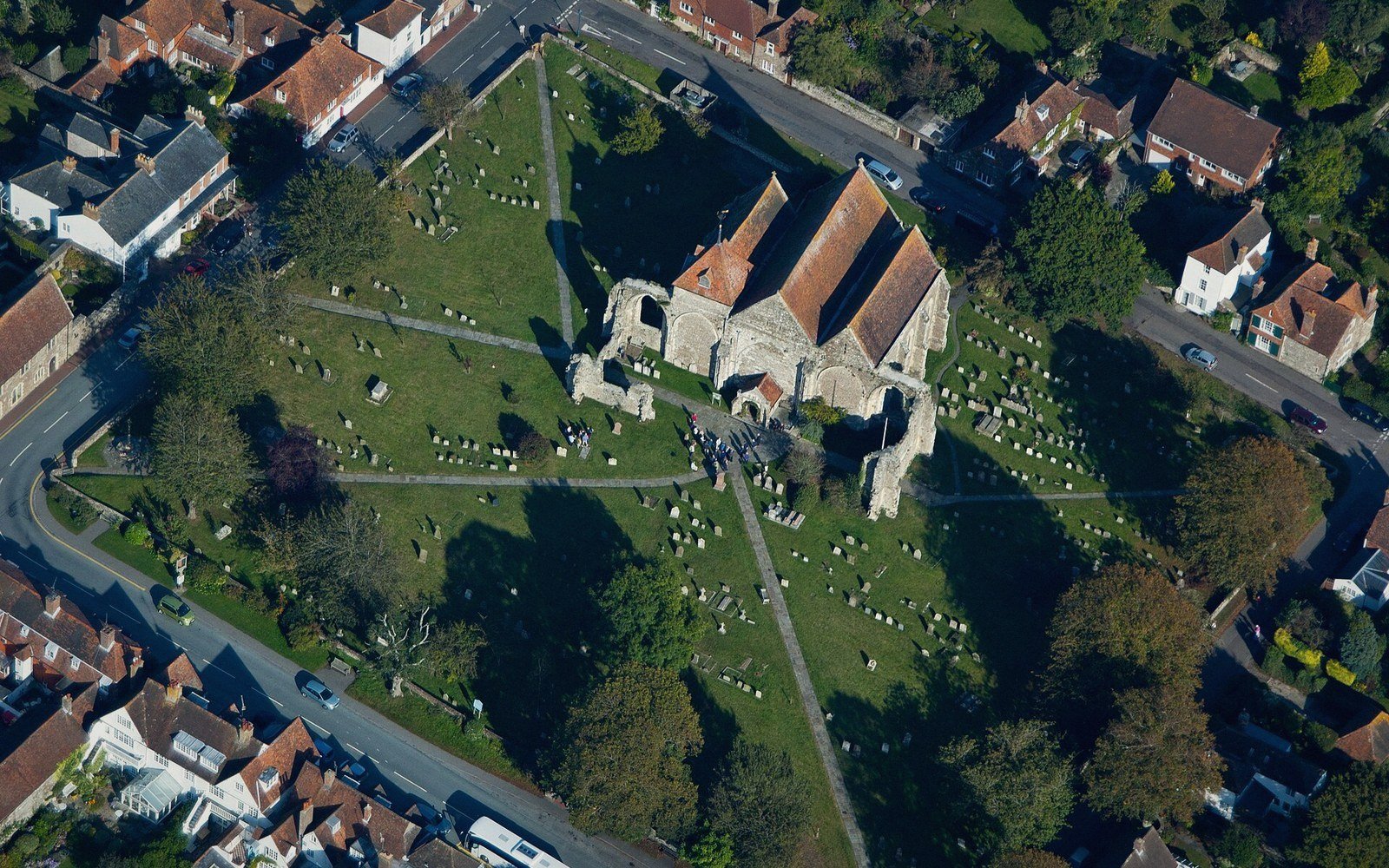
That gap between intention and outcome is what makes Winchelsea unusual. Most towns were not planned at all; they grew. Winchelsea was planned in full, recorded in detail, and then quietly abandoned, quarter by quarter, to the sheep.